About
The Virtual Raster Builder is a QGIS Plugin to define GDAL Virtual Raster (VRT) files by drag and drop. It helps to create a new raster image by stacking, mosaiking, spatial- oder band-subsetting.
Usage
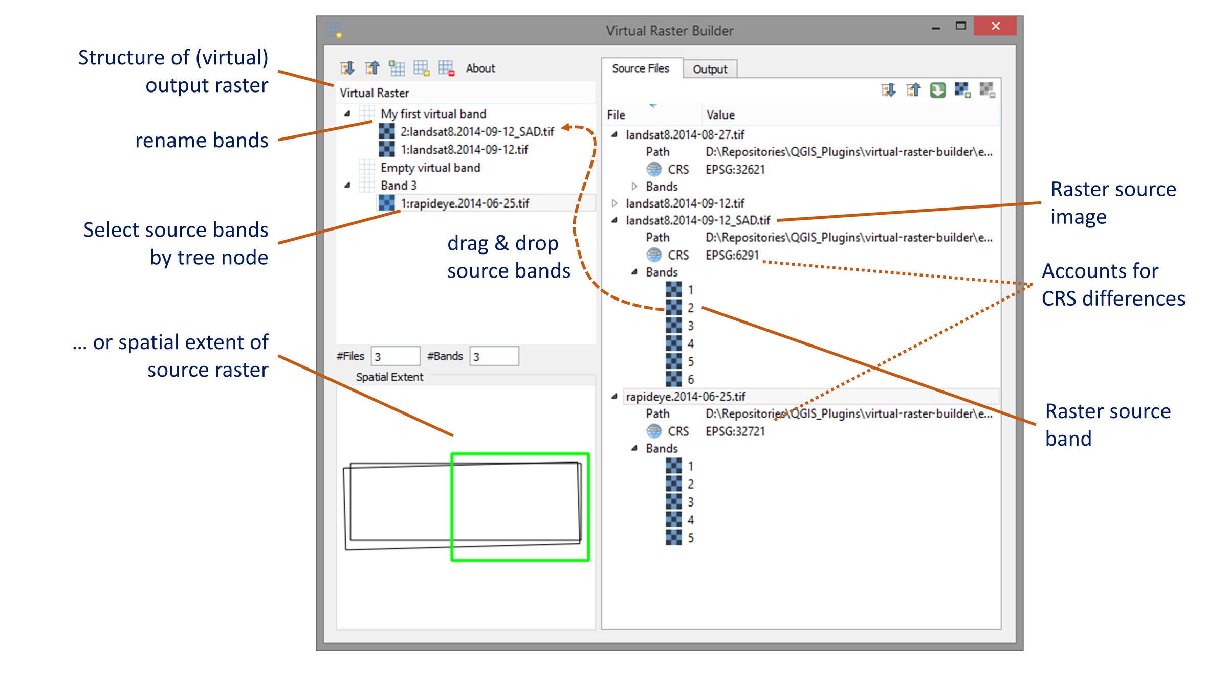
1. Add source files
Add potential raster sources to the list of source files:
| Button | Action |
|---|---|
 |
Add source raster |
 |
Remove source raster |
 |
Load source raster files that are known to QGIS |
 |
Expand source file tree node(s) |
 |
Collapse source file tree node(s) |
2. Specify VRT structure
Specify the VRT structure by drag and drop of source bands
| Button | Action |
|---|---|
 |
Add virtual band |
 |
Remove virtual band |
 |
Import virtual bands from existing VRT file |
|
Expand VRT tree node(s) |
|
Collapse VRT tree node(s) |
 |
Drop bands as band stack (default) |
 |
Drop bands as band mosaik |
- search for source bands using wildcard (band`or regular expression (checkbox `.*).
- activate to drag & drop each of multiple raster bands into a new virtual band (band stack).
If required, new virtual band are created automatically.
- activate to drag & drop multiple raster bands into the same virtual band (band mosaik)
- rename virtual bands with double-click or F2.
3. Specify output settings
- set resampling of source rasters into the output coordinate reference system
- specify the no data value for pixels without any source image data
- set the output raster grid
- set the coordinate reference system
- set the spatial extent in coordinate units or pixel
- set the pixel sizes / ground sampling distance in coordinate units
- set output path & file format
- GDAL Virtual Image (*.vrt, default)
- GeoTIFF (*.tif)
- ENVI Raster Image (*.bsq band sequential (default), *.bil band interleave by line, *.bip band interleave by pixel)
4. Save Virtual Raster
Save the new file as GDAL Virtual Raster (VRT).
In case of other output formats, e.g. GeoTIFF, the VRT is created in a temporary location first and gets translated into the binary file afterwards using gdal.Translate.
Links
| Source Code | https://bitbucket.org/jakimowb/virtual-raster-builder |
| Online Documentation | https://virtual-raster-builder.readthedocs.io/en/latest/ |
| Issue Tracker | https://bitbucket.org/jakimowb/virtual-raster-builder/issues |
| QGIS Plugin Repository | https://plugins.qgis.org/plugins/vrtbuilderplugin/ |
Licence
The Virtual Raster Builder is licenced under the GPL-3 Licence.